Consortia
The Programme is currently implemented by eight Consortia of institutions representing the African continent’s Eastern, Western, Northern, Southern and Central regions.
Rev 20250321
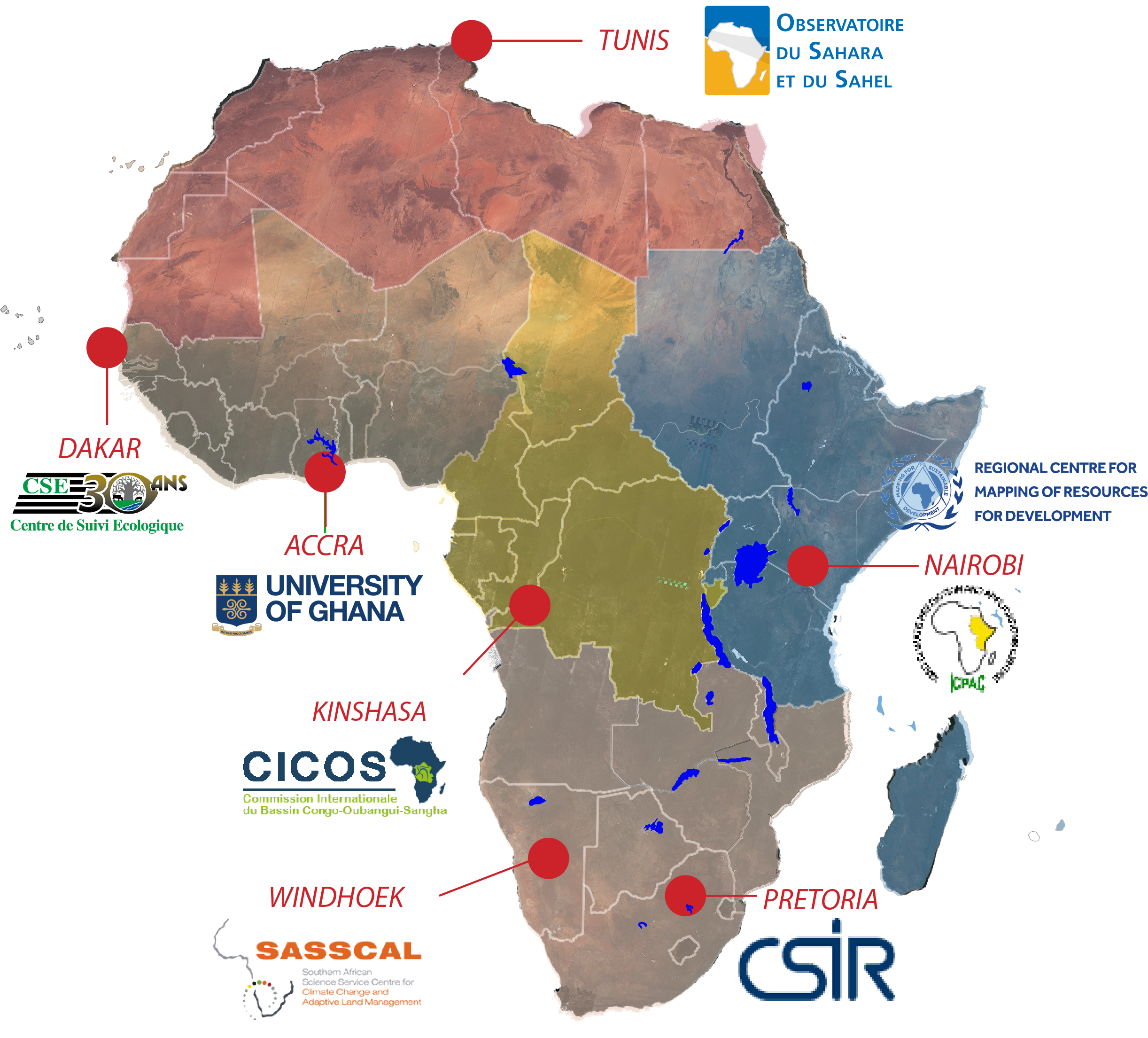
Water Management and Natural Resources in central Africa (GERNAC), led by CICOS - Kinshasa
Rational
Central Africa is a region with abundant water and natural resources. However, managing these resources has been inadequate, resulting in environmental degradation and socio-economic challenges. The GERNAC project aims to address these challenges by improving the region’s monitoring and management of water and natural resources. Through capacity building, awareness raising, and training, the project seeks to empower stakeholders to manage these resources sustainably, ultimately contributing to the socio-economic development of Central Africa.
Consortium Leader
International Commission for the Congo-Oubangui-Sangha Basin (CICOS) - Congo.
Focus
The general objective is to monitor the main impacts of the dynamics of flooded areas in the Central Cuvette on runoff, climate change and biodiversity. The three main applications are:
- Monitoring of water resources, with particular emphasis on the evolution of water levels for river navigation
- Monitoring the hydrological balance of the sub-basins of the Central African region
- Monitoring the dynamics of flooded areas under the forests of the Central Cuvette.
Members
- International Commission for the Congo-Oubangui-Sangha Basin (CICOS), Congo (Lead), https://www.cicos.int/
- Lake Chad Basin Commission (CBLT) - Chad, https://cblt.org/
- Central African Forests Satellite Observatory (OSFAC) - Congo, https://osfac.net/
- University of Kinshasa (UNIKIN) - DRC, https://www.unikin.ac.cd/
- Central African Forest Commission (COMIFAC) - Cameroon, https://comifac.org/
- Waterways Management Authority (RVF) - DRC
- Water and Climate Change Research Centre (CRECC) - Cameroon
- Burundi Geographic Institute (IGEBU) - Burundi, https://www.igebu.bi/
- National Institute for the Conservation of the Environment (INCOMA) - Equatorial Guinea, https://www.incomagq.com/
- National Office of Technical Studies and Development (BNETD) - Côte d’Ivoire, https://www.bnetd.ci
Website(s) and/or Geoportal(s)
Sustainable Wetlands and Flood Management in West Africa (GDZHIAO), led by CSE - Dakar
Rational
The GDZHIAO project aims to help decision-makers and stakeholders manage wetlands and floods in West Africa. Wetlands are important ecosystems that provide resources for food security, water supply, and cultural and recreational activities, but they are vulnerable to degradation from factors such as climate change, deforestation, and urbanization. The project seeks to provide tools, processes, and data to effectively monitor and manage wetlands, monitor and evaluate floods at several scales, and establish a harmonized legislative and regulatory framework for managing these environments in the ECOWAS space.
Consortium Leader
Centre de Suivi Ecologique (CSE) - Senegal.
Coverage
The project covers ten (10) West African countries: Benin, Burkina Faso, Côte d’Ivoire, Gambia, Ghana, Guinea, Mali, Niger, Nigeria, and Senegal.
Focus
The project utilizes earth observation data to increase the resilience of ecosystems to climate change, contributing to food security for populations living near rich and sensitive ecosystems. Beneficiaries and users are provided with quality products on:
- Surface water dynamics (water bodies)
- Surface water turbidity
- Invasive aquatic vegetation
- Dynamic mapping of mangroves
- Monitoring and mapping of flood-prone and flooded areas
- Early warning.
Members
- Centre de Suivi Ecologique (CSE) - Senegal (Lead), https://www.cse.sn/
- National Water Institute (INE) - Benin
- Institute of Geography of Burkina (IGB) - Burkina-Faso, https://www.igb.bf/
- Volta Basin Authority (ABV) - Burkina Faso, https://abv.int/
- Higher Institute of Spatial and Telecommunications Studies (ISESTEL)- Burkina Faso, https://isestel.org/
- University Research and Application Center in Remote Sensing (CURAT) ** – Côte d’Ivoire, https://curat-edu.org/
- Center for Remote Sensing and Geographic Information Services (CERSGIS) - Ghana, https://cersgis.org/
- Center for Scientific and Industrial Research (CSIR) - Ghana, https://www.csir.org.gh/
- University of Ghana (UG) ** - Ghana, https://www.ug.edu.gh/
- Department of Parks and Wildlife (DPW) - Gambia, https://meccnar.gov.gm/parks-and-wildlife
- National Directorate of Living Environment, Surveillance, and Environmental Observation (DNCSOE) - Guinea.
- National Directorate of Water and Forests (DNEF) - Mali, https://eauxetforets.ml/
- Division of Wildlife, Hunting and Protected Areas (DFC/AP) - Niger
- Space for Humanity Foundation - Nigeria
- National Parks Directorate - Senegal, http://www.dpn.gouv.sn
- Center for Space Science and Technology Education (CSSTE) – Nigeria, https://arcsstee.org.ng/
Website(s) and/or Geoportal(s)
Marine and Coastal Observations for Southern Africa and The Indian Ocean (MARCOSIO), led by CSIR - Pretoria
Rational
Coastal management requires continuous monitoring by governments and decision-makers to plan and mitigate risks. By providing readily available tools, processes, and data, stakeholders can respond more effectively. Supporting and empowering local communities to use their ocean resources will create long-term sustainability and secure their livelihoods for the future.
MarCOSIO aims to support Southern Africa and the Indian Ocean regions through a multi-pronged approach that offers critical near-real-time information to governments, decision-makers, private sectors, scientists, and local communities. The project empowers stakeholders to manage and plan effectively towards the sustainable management of African oceans by providing informed marine coastal management practices.
Consortium Leader
Council for Scientific and Industrial Research (CSIR) – South Africa.
Focus
The MarCOSIO project provides and implements co-designed decision-making services to promote sustainable management of marine resources, improve marine governance, and stimulate the growth of the blue economy in the South and East African regions.
Members
- Council for Scientific and Industrial Research (CSIR) – South Africa (Lead), https://www.csir.co.za/
- ABALOBI research group - South Africa, https://abalobi.org/
- Benguela Current Convention (BCC) - Namibia, https://www.benguelacc.org/
- Coastal Oceans Research and Development Indian Ocean (CORDIO) - Kenya, https://cordioea.net/
- Institut Halieutique et des Sciences Marines (IHSM) - Madagascar, https://student.ihsm.mg/
- Institute for Marine Science - Tanzania, https://www.udsm.ac.tz/institute-marine-sciences
- Kenya Marine Fisheries Research Institute (KMFRI) - Kenya, https://www.kmfri.go.ke/
- Mauritius Oceanography Institute (MOI) - Mauritius, https://moi.govmu.org/
- National Sea Rescue Institute (NSRI) - South Africa, https://www.nsri.org.za/
- Tanzania Fisheries and Research Institute (TAFIRI) - Tanzania, https://www.tafiri.go.tz/
- University of Eduardo Mondlane (UEM) - Mozambique, https://uem.mz/
- West Indian Ocean Marine Science Association (WIOMSA) - Tanzania, https://www.wiomsa.org/
Website(s) and/or Geoportal(s)
Monitoring Natural Resources and Food Security in Eastern Africa, led by ICPAC - Nairobi
Rational
The Eastern Africa region remains one of the most vulnerable, with persistent food and nutritional insecurity, widespread economic hardships, resources and political conflicts, irregular and illegal migration and social hardships. With severe climatic changes and environmental degradation and heavily dependent on agriculture and livestock, the region is prone to persistent extremes of severe droughts and flooding.
Mitigating the effects of drought and environmental degradation, boosting agricultural production, sustainable management of natural resources and protecting the environment are part of the region’s priorities. ICPAC, via the GMES and Africa project, ensures resilient livelihoods and sustains the region’s economic growth.
Consortium Leader
IGAD Climate Prediction & Applications Centre (ICPAC) - Kenya.
Focus
In line with the African Union Agenda 2063 and Space Agenda, the consortia facilitate access and utilization of Earth Observation data and technologies for sustainable development in the area of Natural Resource and Food Security Management in the East Africa region.
During the second phase of GMES & Africa, in line with the African Union Agenda 2063 and Space Agenda, the consortium will advance access and utilization of Earth Observation data and technologies for sustainable development in the area of Natural Resource and Food Security Management in the East Africa region.
Members
- IGAD Climate Prediction & Applications Centre (ICPAC) - Kenya (Lead), https://www.icpac.net/
- Wildlife Research and Training Institute (WRTI) - Kenya, https://wrti.go.ke/
- Tanzania Forest Service Agency (TFS) ** - Tanzania, https://www.tfs.go.tz/
- Makerere University ** - Uganda, https://mak.ac.ug/
- Ministry of Land, Water and Environment - Eritrea
- Ministry of Livestock, Forestry and Range - Somalia, https://molfr.gov.so/
- Uganda Wildlife Authority (UWA) - Uganda, https://ugandawildlife.org/
Website(s) and/or Geoportal(s)
Earth Observation for Sustainable Management of Water and Natural Resources in North Africa, led by OSS - Tunis
Rational
Consortium Leader
Coverage
Focus
- Seasonal Agriculture Monitoring and Early Warning (>MISBAR).
- Estimating withdrawals and Water Use Monitoring in irrigated areas (>MISBAR)
- Land Degradation Monitoring (>MISLAND).
Members
- Observatoire du Sahara et du Sahel (OSS) - Tunisia (Lead), https://www.oss-online.org/
- UN-affiliated African Regional Centre for Space Science and Technology Education- in French Language (CRASTE-LF) - Morocco, https://crastelf.org.ma/
- Regional Remote Sensing Center for North African States (CRTEAN) - Tunisia, https://crtean.org.tn/
- National Center for Cartography and Remote Sensing (CNCT) - Tunisia, https://cnct.defense.tn/
- Desert Research Center (DRC) - Egypt, https://drc.gov.eg/
- Libyan Center for Remote Sensing and Space Sciences - Libya, https://www.facebook.com/lcrsss/
- University of Nouakchott Al-Aasriya – Mauritania
- TENMIYA NGO - Mauritania, http://www.tenmiya.com/
Website(s) and/or Geoportal(s)
Land degradation an Wetlands Monitoring and Assessment in Eastern Africa, led by RCMRD - Nairobi
Rational
Consortium Leader
Coverage
Focus
- Land Degradation Monitoring and Assessment
- Wetlands Monitoring and Assessment
- Open Geographical Regional Reference Vector Database for Water and Agro-Ecological Zonings.
Members
- Regional Centre for Mapping of Resources for Development (RCMRD) - Kenya (Lead), https://rcmrd.org/
- Makerere University ** – Uganda, https://mak.ac.ug/
- Ethiopia Space Technology and Geospatial Institute (ESTGI) - Ethiopia, http://ssgi.gov.et/
- Rwanda Water Resources Board - Rwanda, https://www.rwb.rw/
- Higher Council for Environment and Natural Resources (HCENR) - Sudan, https://hcenr.gov.sd/
- Department of Resource Surveys and Remote Sensing (DRSRS) - Kenya, https://www.drsrs.go.ke/
- Ministry of Land, Water and Environment - Eritrea
- National Bureau of Statistics (NBS), Department of GIS, Remote Sensing and Cartography - South Sudan, https://nbs.gov.ss/
- Cellule Cartographie de la DATUH Mapping Unit - Comoros
- Ministry of Environment and Sustainable Development - Djibouti
- Tanzania Forest Services (TFS) ** -Tanzania, https://www.tfs.go.tz/
- Almaas University - Somalia, https://almaas.edu.so/
Website(s) and/or Geoportal(s)
Wetland Assessment and Monitoring Services for Transboundary Basins in Southern Africa (WeMAST), led by SASSCAL - Windhoek
Rational
Consortium Leader
Focus
Members
- Southern African Science Service Centre for Climate Change and Adaptive Land Management (SASSCAL) - Namibia (Lead), https://sasscal.org
- University of Botswana - Botswana, https://www.ub.bw/
- University of Western Cape - South Africa, https://www.uwc.ac.za/
- University of Zambia - Zambia, https://www.unza.zm/
- University of Namibia - Namibia, https://www.unam.edu.na/
- Midlands State University - Zimbabwe, https://ww5.msu.ac.zw/
- National Remote Sensing Centre - Zambia, https://www.nrsc.org.zm/
- WaterNet, SADC - Bostwana, https://www.sadc.int/training/sadc-waternet
Website(s) and/or Geoportal(s)
Marine and Coastal Areas Management in North and West Africa (MarCNoWA), led by UOG - Accra
Rational
Consortium Leader
Coverage
Focus
- Monitoring and Forecasting of Oceanographic Variables
- Coastline Changes (Coastal Ecosystems Mapping and Monitoring, Coastal Vulnerability Mapping)
- Oil Spills Monitoring and Warning
- Mapping of PFZs & Vessel Traffic
- Forecast of Ocean State and Ocean Weather Conditions
Members
- University of Ghana (UG) - Ghana (Lead), https://www.ug.edu.gh/
- Nigerian Institute for Oceanography and Marine Research (NIOMR) - Nigeria, https://niomr.gov.ng/
- Centre Universitaire De Recherche d’Application en Télédétection (CURAT) ** - Cote d’Ivoire, https://curat-edu.org/
- Institut de Recherches Halieutiques et Océanologiques du Bénin (IRHOB) – Benin, https://www.facebook.com/IRHOBBenin/
- Centre for Oceanographic Research of Dakar-Thiaroye (CRODT) - Senegal
- Ghana Meteorological Agency (GMet) - Ghana, https://www.meteo.gov.gh/
- Centre for the Environment for Arab Region and Europe (CEDARE) - Egypt, https://new.cedare.org/new.cedare.org/
- Centre d’Etudes et de Recherche des Télécommunications (CERT) – Tunisia, https://www.facebook.com/CERT.PageOfficielle/
- Chouaib Doukkali University (UCD) - Morocco, https://www.ucd.ac.ma/
- Nature Today (NT) – Ghana, https://naturetodaygh.com/
- Edenway Foundation - Ghana, https://edenwayfoundation.com/


Comments
Post a Comment