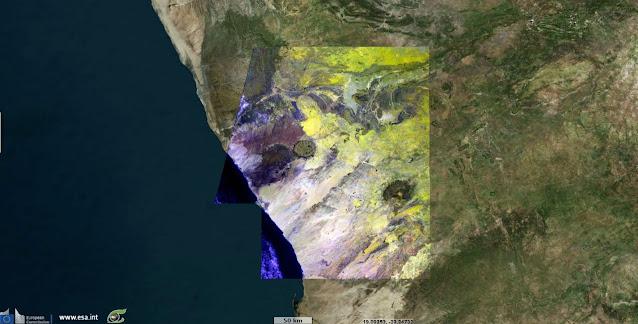
ESA Sentinel Vision Portal: Geologic features of the Erongo region, Namibia
Erongo is one of the 14 regions of Namibia. The capital is Swakopmund. The region comprises the Swakopmund magisterial district up to the Ugab River and includes the Walvis Bay, Omaruru and Karibib magisterial districts.
This region is named after Mount Erongo, a well-known landmark in Namibia and in this area. All the main centres within this region are connected by paved roads.
About
Special thanks to Serge Riazanoff and Guillaume AUREL
The SentinelVision EVT-719 is funded by the EU and ESA and powered by VisioTerra
 |
| Sentinel 2 image dated 31.12.2017 |
This region is named after Mount Erongo, a well-known landmark in Namibia and in this area. All the main centres within this region are connected by paved roads.
About
- Sentinel-2 is one of the Earth observation missions from the Copernicus Programme that systematically acquires optical imagery at high spatial resolution (10 m to 60 m) over land and coastal waters. The mission is a constellation with two twin satellites, Sentinel-2A and Sentinel-2B.
- The mission supports a broad range of services and applications such as agricultural monitoring, emergencies management, land cover classification or water quality.
- Overview of S2, mission objectives, satellite description, ground segment, data products and, infographic: https://sentinel.esa.int/web/sentinel/missions/sentinel-2
Special thanks to Serge Riazanoff and Guillaume AUREL
The SentinelVision EVT-719 is funded by the EU and ESA and powered by VisioTerra


Comments
Post a Comment